Latest GeoComm updates

GeoComm Launches Map Converter to Accelerate the Conversion of Static Floorplans into Response Ready Indoor GIS Data
New public safety grade solution accelerates static floorplan-to-GIS conversion, helping public safety, school safety, healthcare, and critical infrastructure organizations improve situational awareness, coordination, and response readiness ST. CLOUD, Minn. – June 24, 2026 – GeoComm, leading provider of public safety grade location data and mapping solutions, today announced GeoComm Map Converter, a new solution designed to help organizations...

Drone as First Responder Programs Need Indoor Maps Too
By John Brosowsky, SVP of Innovation, and Tracy “Mac” McElvaney, Chief Product & Innovation Officer, GeoComm Bridging the Gap Between Aerial and Interior Response Drone as First Responder programs are increasingly becoming part of modern public safety operations. They can provide rapid aerial situational awareness, help agencies assess scenes sooner, and give commanders and field responders more context before personnel...

GeoComm Joins Make Our Schools Safe as 2026 Annual Partner to Help Strengthen School Emergency Response
News provided by GeoComm, Inc Jun 03, 2026, 10:31 ET Partnership connects school safety advocacy with public-safety-grade indoor mapping to help schools and first responders access critical information when every second matters. ST. CLOUD, Minn. and PARKLAND, Fla., June 3, 2026 /PRNewswire/ — GeoComm, a trusted provider of Public Safety Grade indoor mapping and location intelligence solutions,...
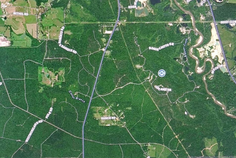
Washington Parish, Louisiana Utilizes GeoComm Dispatch Map to Help Locate Lost Hiker
Washington Parish Louisiana Communications District is dedicated to providing the most accurate and current 9-1-1 equipment in their emergency communications center. That dedication proved to be a wise investment when they received a 9-1-1 call from a hiker in the Bogue Chitto State Park who had gotten lost on one of the trails in the woods.

State of Wisconsin Selects GeoComm for Statewide NG9-1-1 GIS Project
GeoComm is excited to announce they have been selected by the State of Wisconsin to complete a Next Generation 9-1-1 (NG9-1-1) GIS Consulting Project. As the State of Wisconsin transitions to a NG9-1-1 environment, the need for a robust GIS environment at local, regional, and statewide agencies dramatically increases.

GeoComm Celebrating Twenty-Five Years of Empowering Our Customers to Create Powerful 9-1-1 and NG9-1-1 System Public Safety Grade GIS Data
When founded in 1995, GeoComm provided turnkey emergency services to local county governments and throughout the years has grown to not only serve local county governments but also, regional and statewide government agencies as well as some military agencies spanning forty-nine different states, protecting more than 100 million people.

Over 1,500 Jurisdictions Leveraging the Power of GeoComm GIS Data Hub
GeoComm, a leader in Public Safety GIS solutions, is excited to announce that over 1,500 jurisdictions across the country are now utilizing GeoComm GIS Data Hub as an integral part of their Public Safety GIS data management process. By leveraging this system, users are able to measure progress towards developing and maintaining Public Safety Grade GIS

GeoComm Selected By Monterey County, California for GIS Maintenance Project
GeoComm is excited to announce they have been selected by Monterey County, California for a three year GIS maintenance project. This project will help ensure Monterey County has high quality Public Safety Grade GIS data needed for their Computer Aided Dispatch (CAD) system and support for the new California Statewide NG9-1-1 system.

Oklahoma Counties able to Seamlessly Purchase GeoComm’S Proven GIS Solutions on Oklahoma Office of Management and Enterprise Services Purchasing Contract
GeoComm, a leading provider of public safety GIS software and solutions, has been awarded an Oklahoma Office of Management and Enterprise Services (OMES) contract for GeoComm’s public safety software and solutions.
GeoComm selected by Lake County, Florida for GIS Assessment and Improvement Project
GeoComm is excited to announce being selected by Lake County, Florida for a GIS project aimed at preparing their GIS data for the mission critical role it will play in future NG9-1-1 systems.

GeoComm joins Amazon Web Services Partner Network
GeoComm, a leading provider of public safety GIS software and solutions, is excited to announce they are now a partner in the Amazon Web Services (AWS) Partner Network (APN). The APN is the global program for technology and consulting customers who leverage AWS to build solutions and services for customers.

City of Austin, Texas Completes Project Aimed at Improving GIS Data Provided in Their CAD System
The City of Austin, Texas was recently experiencing some difficulties with spoken vehicle routing directions provided in their Computer Aided Dispatch (CAD) mobile units and requested GeoComm review and update their GIS data to improve vehicle routing directions.
