Latest GeoComm updates

GeoComm Launches Map Converter to Accelerate the Conversion of Static Floorplans into Response Ready Indoor GIS Data
New public safety grade solution accelerates static floorplan-to-GIS conversion, helping public safety, school safety, healthcare, and critical infrastructure organizations improve situational awareness, coordination, and response readiness ST. CLOUD, Minn. – June 24, 2026 – GeoComm, leading provider of public safety grade location data and mapping solutions, today announced GeoComm Map Converter, a new solution designed to help organizations...

Drone as First Responder Programs Need Indoor Maps Too
By John Brosowsky, SVP of Innovation, and Tracy “Mac” McElvaney, Chief Product & Innovation Officer, GeoComm Bridging the Gap Between Aerial and Interior Response Drone as First Responder programs are increasingly becoming part of modern public safety operations. They can provide rapid aerial situational awareness, help agencies assess scenes sooner, and give commanders and field responders more context before personnel...

GeoComm Joins Make Our Schools Safe as 2026 Annual Partner to Help Strengthen School Emergency Response
News provided by GeoComm, Inc Jun 03, 2026, 10:31 ET Partnership connects school safety advocacy with public-safety-grade indoor mapping to help schools and first responders access critical information when every second matters. ST. CLOUD, Minn. and PARKLAND, Fla., June 3, 2026 /PRNewswire/ — GeoComm, a trusted provider of Public Safety Grade indoor mapping and location intelligence solutions,...
GeoComm Launches Map Converter to Accelerate the Conversion of Static Floorplans into Response Ready Indoor GIS Data
New public safety grade solution accelerates static floorplan-to-GIS conversion, helping public safety, school safety, healthcare, and critical infrastructure organizations improve situational awareness, coordination, and response readiness ST. CLOUD, Minn. – June 24, 2026 – GeoComm, leading provider of public safety grade location data and mapping solutions, today announced GeoComm Map Converter, a new solution designed to help organizations...
GeoComm Joins Make Our Schools Safe as 2026 Annual Partner to Help Strengthen School Emergency Response
News provided by GeoComm, Inc Jun 03, 2026, 10:31 ET Partnership connects school safety advocacy with public-safety-grade indoor mapping to help schools and first responders access critical information when every second matters. ST. CLOUD, Minn. and PARKLAND, Fla., June 3, 2026 /PRNewswire/ — GeoComm, a trusted provider of Public Safety Grade indoor mapping and location intelligence solutions,...

GeoComm Announces Partnership with The Geospatial Group to Strengthen Public Safety GIS and Location Intelligence Support
News provided by GeoComm, Inc May 28, 2026, 14:30 ET Partnership brings together GeoComm’s Public-Safety-Grade location intelligence with The Geospatial Group’s GIS consulting, integration, and custom mapping expertise ST. CLOUD, Minn., May 28, 2026 /PRNewswire/ — GeoComm, the nation’s leader in Public-Safety-Grade location intelligence, today announced a new partnership with The Geospatial Group, a Mississippi-based GIS and IT...

GeoComm and StrataSite Partner to Help Schools Strengthen Preparedness and Improve Coordinated Response
Partnership connects trusted indoor mapping with coordinated response planning, training, and readiness tools to help schools and emergency responders align faster, reduce confusion, and act with greater confidence. ST. CLOUD, Minn., May 19, 2026 /PRNewswire/ — GeoComm, the provider of public-safety-grade location intelligence that underpins critical incident response, and StrataSite, a collaborative incident action planning solution, today...

GeoComm Indoor Mapping Integration with Zetron Help Strengthen Iowa Public Safety Response
Integration brings indoor building context into Zetron workflows to help public safety teams respond faster, coordinate more effectively, and improve situational awareness during indoor emergencies across Iowa. St. Cloud, Minn. – April 28, 2026 – GeoComm today announced an integration that brings GeoComm indoor mapping content into Zetron’s Map Viewer, helping support public safety agencies...

GeoComm and Unknot.id Partner to Deliver Advanced Indoor Location Intelligence for Public Safety and Enterprise Environments
ST. CLOUD, Minn. and ORLANDO, Fla., April 14, 2026 – GeoComm and Unknot.id have partnered to bring public-safety-grade indoor location capabilities to public safety and enterprise environments where reliable, highly accurate maps and indoor positioning are mission critical. By extending trusted location awareness indoors, the partnership helps responders and facility teams navigate complex buildings more...
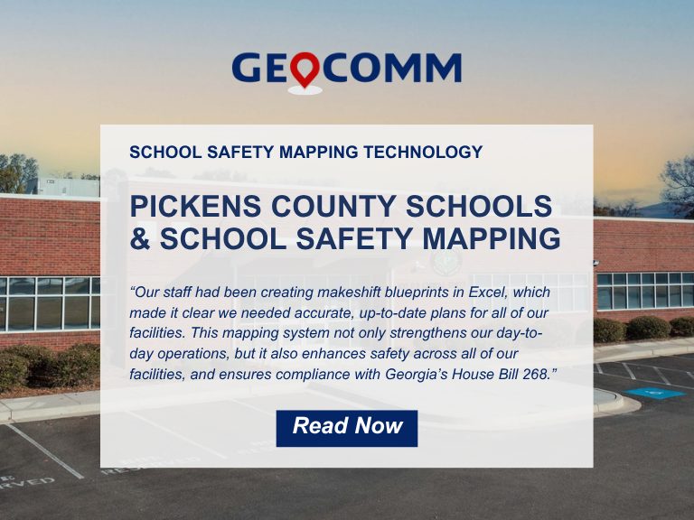
Pickens County School District Strengthens School Safety with GeoComm’s Interactive Indoor Mapping Solution
Pickens County, GA, April 2, 2026: Pickens County School District has taken a major step forward in enhancing school safety by implementing GeoComm’s School Safety mapping solution. Serving approximately 4,000 students across eight campuses, the school district partnered with GeoComm to map over 875,000 square feet of indoor space. The project was completed in just...

Bixby Public Schools Strengthens Emergency Preparedness With GeoComm’s School Safety Mapping Technology
St. Cloud, MN, February 16, 2026: Bixby Public Schools in Bixby, Oklahoma has partnered with GeoComm to implement districtwide school safety mapping across its 10 campuses, covering over 1.7 million square feet and supporting over 7,000 students. As one of the fastest -growing school districts in the state, Bixby Public Schools faced growing complexity in...

GeoComm Appoints TJ Kennedy as CEO to Lead Next Chapter in Public Safety Innovation
St. Cloud, MN – October 22, 2025 – GeoComm, today announced new executive leadership to accelerate its transformation as the nation’s most trusted provider of public safety GIS and indoor mapping. TJ Kennedy has been named Chief Executive Officer bringing decades of expertise to advance GeoComm’s mission of delivering life-saving location intelligence for first responders,...