Latest GeoComm updates

AI Needs GIS
By John Brosowsky, SVP of Innovation, GeoComm Artificial intelligence is rapidly reshaping PSAP operations. From handling non-emergency calls to enabling real-time 9-1-1 transcription, translation, keyword detection, and call taker assistance, AI is becoming an integral part of modern emergency communications. But AI is not inherently intelligent; it identifies patterns and relationships within the information it has been trained on...

GeoComm and geoConvergence Announce Partnership to Support the Future of Indoor Mapping
Partnership highlights the increasing role of accurate indoor maps, GIS data, and public safety grade location intelligence in emergency response, school safety, and facility operations. ST. CLOUD, Minn., July 10, 2026 /PRNewswire/ — GeoComm, the nation’s leader in public safety grade location intelligence, today announced a new partnership with geoConvergence, a GIS consulting firm based in Bloomington, Indiana....

GeoComm Launches Map Converter to Accelerate the Conversion of Static Floorplans into Response Ready Indoor GIS Data
New public safety grade solution accelerates static floorplan-to-GIS conversion, helping public safety, school safety, healthcare, and critical infrastructure organizations improve situational awareness, coordination, and response readiness ST. CLOUD, Minn. – June 24, 2026 – GeoComm, leading provider of public safety grade location data and mapping solutions, today announced GeoComm Map Converter, a new solution designed to help organizations...

How New Mexico Strengthened Emergency Response with Public Safety Grade GIS Data
Ensuring Accurate Location Data Across 100+ Local Governments. Overview In New Mexico, a largely rural state with vast geographic areas and limited emergency resources, even small GIS data errors can have life-threatening consequences. With more than 100 local government agencies contributing GIS data and over 40 Public Safety Answering Points (PSAPs) relying on that data...
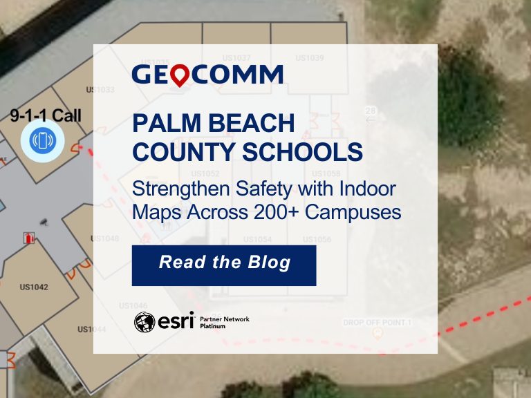
Palm Beach County Schools Strengthen Safety with Indoor Maps Across 200+ Campuses
Ensuring safety across a large school district requires more than traditional emergency plans. For the Palm Beach County School District, the tenth-largest school district in the United States, protecting students and staff means preparing for emergencies across hundreds of campuses and thousands of buildings. To strengthen situational awareness and emergency response, the district partnered with GeoComm to implement a...
How Denco 9-1-1 Locates Callers Indoors Using GeoComm’s Indoor Mapping
Indoor Mapping for Emergency Response & Public Safety Overview: Denco 9-1-1 Enhances School Safety with Indoor Mapping Denco Area 9-1-1 District (Denco 9-1-1) partnered with GeoComm in late 2019 to tackle the critical challenge of locating 9-1-1 callers indoors. The Indoor Map Development Project aimed to enhance Emergency Communications Center (ECC) mapping capabilities by leveraging...
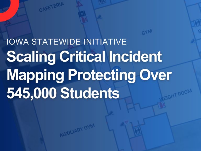
Iowa’s School Safety Initiative: Critical Incident Mapping & 9-1-1 Emergency Response at Scale
Overview: Iowa School Safety Initiative As part of Governor Reynolds’ School Safety Initiative, GeoComm partnered with the Iowa Department of Education to implement Critical Incident Mapping (CIM) for more than 1,400 schools statewide. Nationally, schools generate an estimated 2,250 emergency calls to 9-1-1 each year, underscoring how often responders are asked to navigate complex, unfamiliar...

Southwest Minnesota: Digital Geographic Information System Mapping & 9-1-1 Emergency Response
Overview In 2023, the Southwest Minnesota Emergency Communications Board (SWECB) partnered with GeoComm to launch an indoor mapping pilot project. This digital geographic information system mapping initiative transformed critical infrastructure buildings into GIS-powered indoor maps, providing first responders with precise, real-time location intelligence and the school mapping data needed to ensure effective emergency response. The...

Tri-County School Safety Pilot Project
The Tri-County School Safety Pilot Project aimed to create detailed GIS indoor maps of seven pilot schools in the Tri-County area to improve response times to school incidents. The maps were shared with dispatch centers to be used in their 9-1-1 applications.

Concho Valley Council of Governments (CVCOG), Texas Exploring a New Way to Make Schools Safer Using GIS
CVCOG provides emergency communications services for approximately 16,300 square mile region in West Texas, supporting 15 Public Service Answering Points (PSAPs) within the thirteen-county region.

Denco 9-1-1 Brings Indoor Maps to Schools, Providing 9-1-1 Actionable Location Information
Denco Area 9-1-1 District (Denco 9-1-1), providing 9-1-1 services to nearly 800,000 people in 33 jurisdictions throughout North Texas, recently worked with GeoComm to bring indoor maps to 86 K-12 public schools throughout the region.