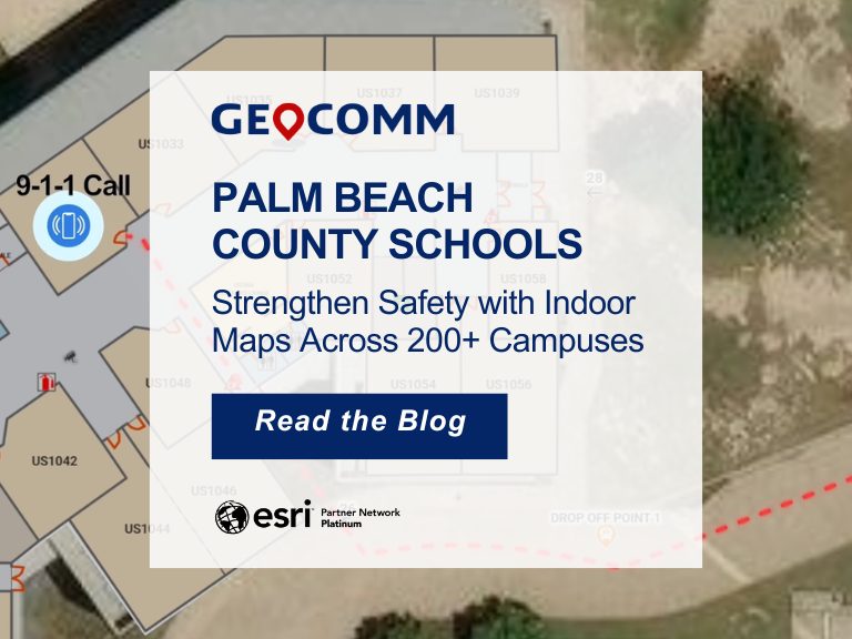
Iowa’s School Safety Initiative: Critical Incident Mapping & 9-1-1 Emergency Response at Scale
Overview: Iowa School Safety Initiative
As part of Governor Reynolds’ School Safety Initiative, GeoComm partnered with the Iowa Department of Education to implement Critical Incident Mapping (CIM) for more than 1,400 schools statewide. Nationally, schools generate an estimated 2,250 emergency calls to 9-1-1 each year, underscoring how often responders are asked to navigate complex, unfamiliar buildings under pressure.
Through this initiative, GeoComm helps protect more than 545,000 students across Iowa by equipping schools and first responders with verified, responder-ready indoor maps and critical location data. GeoComm’s School Safety team conducted on-site visits to validate floor plan accuracy, scan school buildings, and collect public safety points of interest in and around each campus—ensuring responders arrive informed, oriented, and ready to act.
The Challenge: Delayed Response Without Indoor Maps
Limited indoor navigation made it difficult for first responders to quickly locate people and places during school emergencies. To improve response times, Iowa needed accurate, real-time mapping data to guide telecommunicators and first responders inside school buildings.
The Solution: Critical Incident Mapping
Designed to address all forms of school emergencies, GeoComm’s School Safety solution enable emergency incident and 9-1-1 caller locations to be displayed on a comprehensive digital representation of the school.
School security officials can also access the maps on both web and mobile devices. Additionally, the maps are securely shared with public safety agencies via RapidSOS and other mission-critical software applications through GeoComm’s Public Safety Content Library.
Real-World Impact
“Their indoor maps enable our staff to quickly and accurately locate any area within the school – its been invaluable for our staff and emergency responders.”
-Justin Stockdale, Superintendent, Dike-New Hartford Community Schools
Project Highlights
- 300M+ total square footage of indoor space mapped in Iowa
- 545K+ students protected
- 1,400+ schools mapped across Iowa
- 15 months to map over 1,400 schools
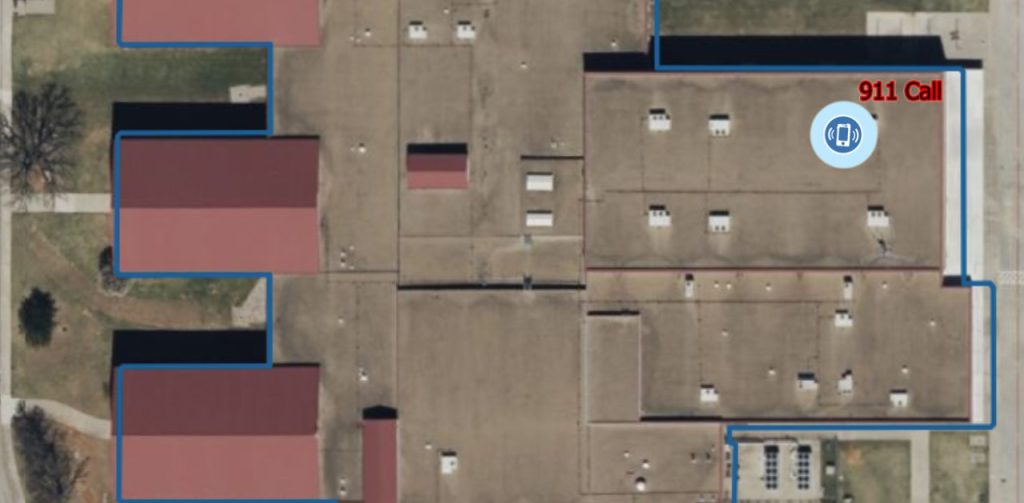
BEFORE: School and emergency officials view a map with limited location information.
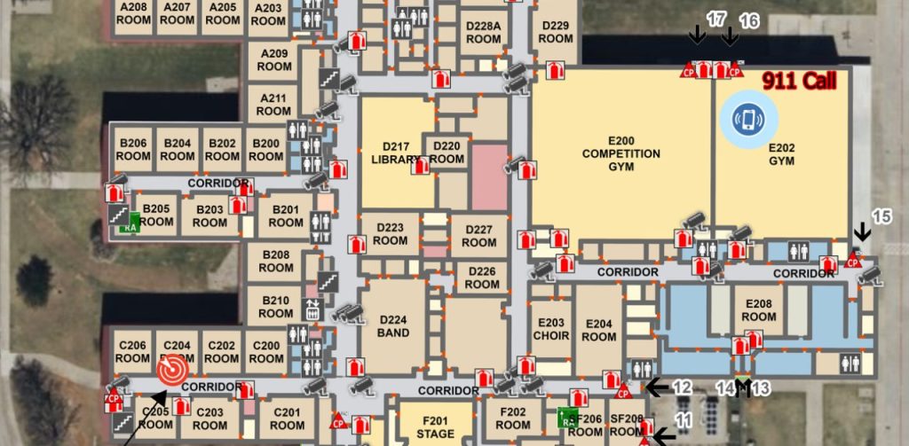
AFTER: A detailed common operating picture is now shared among school and emergency officials.
Next Steps
GeoComm’s school mapping data and critical incident mapping empowers emergency responders with the intelligence they need—when seconds matter most. Want to learn how GIS-powered indoor maps can enhance safety and save lives in your district?
👉 Contact us today for a free consultation or GIS map review.
Learn more about GeoComm’s School Safety Maps
Watch how GIS data is used in GeoComm’s School Safety Maps