Why School Safety is Built Before a Crisis
By Rose Bentley, Chief Operating Officer, GeoComm
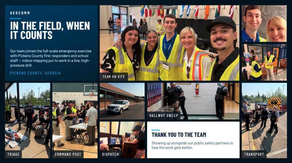
Last week, I stood inside an elementary school in Georgia and watched a community put months of preparation into practice. In that moment, our work felt very different than lines on a screen, GIS data, or a completed project. It became real.
The school was Harmony Elementary. Earlier this year, our team mapped the facility as part of our commitment to helping communities prepare for emergencies. Last week, during the annual school safety drill, we had the opportunity to see that work come full circle.
As the exercise began, local fire, sheriff’s office, EMS personnel, school leaders, and emergency teams coordinated their response plans. Behind the scenes, GeoComm’s map served as a critical tool for the dispatch center, providing the location intelligence needed to communicate clearly, understanding the building layout, and support decision-making throughout the exercise. While the map was not the focus of the drill, it played an important role in helping ensure responders had the information they needed to navigate the incident effectively.
Then the simulation started. Mock gunfire echoed through the hallways, and a lockdown message repeated over the intercom: “Lock. Lights out. Out of sight.” Teachers followed established procedures while first responders moved room by room, clearing hallways, securing spaces, and transporting simulated victims to a central triage area. Everyone knew it was a drill, but the emotions were real. There were tears from teachers, tears from first responders, and tears from observers. Even in a controlled exercise, the weight of what these professionals prepare for every day was impossible to ignore.
What struck me most was realizing that our work doesn’t end when we deliver a map. The map becomes part of how a community prepares. It becomes part of how dispatchers coordinate information, how first responders train, and how schools protect students and staff. Watching the exercise unfold reinforced the importance of having accurate location information available before an emergency occurs. Reliable location intelligence quietly supports the decisions, communication, and coordination that make an effective response possible.
That realization reinforced three simple truths: this is why accuracy matters, this is why speed matters, and this is why we matter.
At GeoComm, we often talk about helping save lives through better location intelligence. Sometimes it’s easy to focus on the technology, the data, the processes, or the deliverables. Those things matter, but they are not the reason we do what we do. The reason is people: students, teachers, first responders, and the communities they serve.
Our technology didn’t just support a drill. It supported a community preparing to protect its children. And that experience reminded me of something important: preparedness is not built during a crisis. It is built long before one occurs through planning, training, partnership, communication, and practice.
That is also why GeoComm continues to evolve. As an organization, we are investing in new capabilities, new partnerships, and new ways to serve our customers. Not because growth is the goal, but because impact is. Every improvement we make should ultimately lead to more communities being prepared, more first responders having the information they need, more schools equipped to respond when seconds matter, and more lives protected.
The experience at Harmony Elementary was a powerful reminder of what’s at stake and why our mission matters. Because school safety is not built during a crisis. It’s built before one. And that is exactly why we do this work.
Learn more about GeoComm Indoor Safety