Unlocking the Power of Map Data Manager: Enhancing School Safety & Indoor Safety
An indoor map delivers the next level of precise location information via a highly organized visualization of all the essential elements in a building. Bringing your building to life with a detailed map and into the hands of those who need it is a critical first step to unlocking seamless navigation and enhanced accessibility!
However, creating the indoor map for a school or another key building is just the beginning—it is the foundation for ongoing changes; buildings are changing constantly. The indoor map representations of those facilities require living GIS data that continuously updates as the buildings change. This will provide First responders who rely on this data with confidence that the data is accurate and complete.
To support these efficient updates to the maps, GeoComm’s School Safety and Indoor Safety offerings include access to the Indoor Map Data Manager. GeoComm’s School Map Data Manager is an easy-to-use drag-and-drop interface that provides new public safety points of interest, indicates required changes to the map, renames rooms, and uploads new source materials.
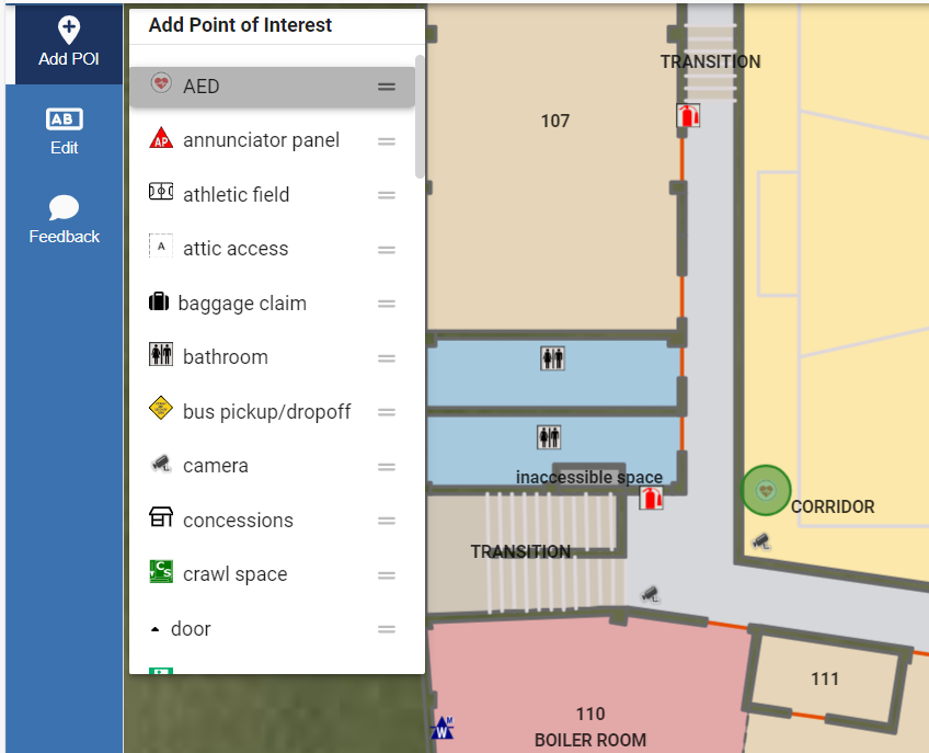
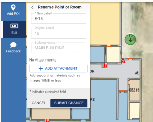
As soon as any feedback is submitted, our team uses streamlined processes to incorporate the changes into the map, conduct quality control, and share the changes with public safety. Our team continues to add new points of interest types and makes them available to customers to include in their indoor maps.
For more information on how to utilize this transformative feature, check out our website www.geocomm.com or email us at geocomm@geocomm.com.
Learn more about GeoComm School Safety Critical Incident Mapping solution
September 25, 2024