How Denco 9-1-1 Locates Callers Indoors Using GeoComm’s Indoor Mapping
Indoor Mapping for Emergency Response & Public Safety
Overview: Denco 9-1-1 Enhances School Safety with Indoor Mapping
Denco Area 9-1-1 District (Denco 9-1-1) partnered with GeoComm in late 2019 to tackle the critical challenge of locating 9-1-1 callers indoors. The Indoor Map Development Project aimed to enhance Emergency Communications Center (ECC) mapping capabilities by leveraging indoor maps and GIS data to improve situational awareness and response efficiency.
The Challenge: No Indoor Map, Slower Response
First responders in the Denco 9-1-1 District often faced delays navigating large, complex university buildings due to limited indoor maps. To enhance emergency response, the district needed accurate, real-time indoor location data to help 9-1-1 telecommunicators and responders pinpoint exact caller locations within campus facilities.
The Solution: Smart Indoor Mapping for Emergency Response
Through stakeholder education, analysis of school floor plans, and the development of high-quality indoor datasets, the project successfully mapped 884 buildings—including 434 schools and 149 government facilities. As a result, Denco 9-1-1 gained precise indoor location data, empowering first responders with visual representations of key buildings, leading to faster and more informed emergency response.
Real-World Impact
“The addition of indoor maps integrated with our 9-1-1 software supports emergency personnel identification of specific room locations of 9-1-1 callers.“
-Greg Ballentine, Executive Director, Denco Area 9-1-1 District
Project Highlights
- 35M+ total square footage of indoor buildings mapped
- 33 jurisdictions across north Texas
- 434 schools mapped
- 800K+ total residents protected
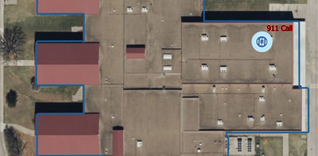
BEFORE: School and emergency officials view a map with limited location information.
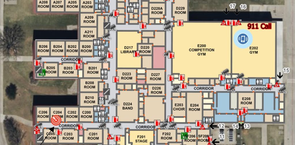
AFTER: A detailed common operating picture is now shared among school and emergency officials.
Next Steps
GeoComm’s school mapping data and indoor mapping empowers emergency responders with the intelligence they need—when seconds matter most. Want to learn how GIS-powered indoor maps can enhance safety and save lives in your district?
👉 Contact us today for a free consultation or GIS map review.
Learn more about GeoComm’s School Safety Maps
Watch how GIS data is used in GeoComm’s School Safety Maps