
Bring GIS Data Expertise to your Agency
- Our experts are your people Save time and resources with GIS expert support – from identifying errors and data gaps to optimizing processes. We tackle the heavy lifting.
- Achieve GIS data excellence Enhance your on-going data quality with standardization, deduplication, normalization and more to meet public safety requirements.

GIS Data Maintenance Services for Every Challenge
Free up resources, accelerate projects, and be confident in your GIS data.
- GIS expert support
- Save time and resources
- Comprehensive GIS data review and analysis
- Identify data errors and gaps
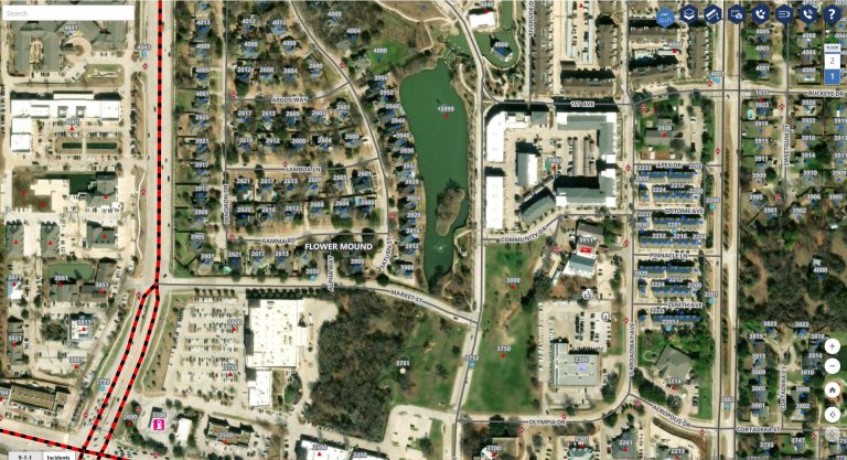
Lean on Our Team to do the Heavy Lifting
Our ongoing GIS data maintenance services provide the insights, tools, and support your team needs to achieve and sustain public safety data excellence.
“GeoComm GIS Services have transformed our data quality. We had errors in our analysis that they helped us fix, and the final product was better than we could have expected. ”

“Thanks to GeoComm, we’ve transformed our GIS data to meet NG911 standards, achieving over 99% accuracy statewide.”

Resources
Best School Safety Mapping Solutions: What to Compare in 2026
Choosing the right school safety mapping solution means looking beyond the map itself. The best solutions provide accurate, responder ready information that helps schools, universities, 9-1-1 centers, and emergency responders understand a location, share critical details, and coordinate during an incident. For school districts evaluating critical incident mapping companies in 2026, the most important considerations…

The Next Generation of DFR Will Be About Decision Intelligence
By Tracy “Mac” McElvaney, Chief Product & Innovation Officer, GeoComm Drone as First Responder has already changed how many public safety agencies think about unmanned aircraft. The ability to launch a drone before a responder arrives on scene can provide valuable situational awareness, help clarify what is happening, and give field personnel additional context before…
How Caller Location Guides NG9-1-1 Call Routing
When someone calls 9-1-1, getting the call to the right Emergency Communications Center (ECC) or Public Safety Answering Point (PSAP) is one of the first critical steps in the emergency response process. In a Next Generation 9-1-1 (NG9-1-1) environment, that decision increasingly depends on one essential piece of information: the caller’s location. Unlike legacy 9-1-1…
