15 Must-Ask Questions to Choose the Best Critical Incident Mapping Solution for Schools
How to choose the best critical incident mapping solution
When it comes to protecting students and staff, selecting the right school safety map is a decision that cannot be taken lightly. Schools must ensure that their critical incident mapping solution is more than just a visual representation of their buildings—it must be a real-time, interactive tool that enhances emergency response, daily operations, and long-term safety planning.
Before committing to a school safety mapping vendor, schools should ask these three essential questions:
- Does the School Safety Map Seamlessly Integrate with First Responders?
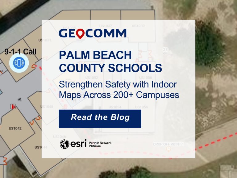
During a crisis, 911 dispatchers, law enforcement, and emergency personnel need instant access to accurate, up-to-date maps of the school. A strong mapping solution should provide a common operating picture, ensuring first responders can quickly locate key entry points, classrooms, and emergency exits before arriving on scene.
- Can the Map Be Updated and Customized to Maintain Accuracy?
Schools are constantly evolving—new buildings, security upgrades, and reconfigured layouts mean a static map quickly becomes outdated. Your mapping solution should allow for easy updates and customization, ensuring safety teams always have the most current data available for emergency planning, logistics, and everyday operations.
- Can the Investment Be Used Beyond Emergency Management?
A digital school safety map should provide value beyond crisis response. Schools should look for solutions that support facilities management, event planning, campus navigation, and security training—ensuring a long-term return on investment.
Before You Choose a Vendor, Ask the Right Questions
Not all school safety mapping solutions are created equal. Ensure your school is making the right choice by downloading our free guide:
📥 “15 Questions Every School Must Ask Before Choosing a School Safety Mapping Vendor.”
👉 Learn more about how GIS data enhances critical incident mapping