Avoiding 9-1-1 Call Failures: How PSAP Boundaries and NG9-1-1 Support Emergency Preparedness
As Next-Generation 9-1-1 (NG9-1-1) continues to evolve, accurate Public Safety Answering Point (PSAP) 911 service area boundaries are more crucial than ever for emergency services. This accuracy is also a foundational component of broader emergency preparedness strategies aimed at improving public safety outcomes.
Why is this so important for emergency preparedness?
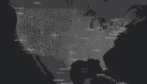
NG9-1-1 Emergency Call Routing Functions (ECRFs) provide location-based route determination to ensure emergency calls are directed to the correct 9-1-1 PSAP quickly. The system compares a 9-1-1 caller’s location with a map of PSAP service area boundaries — essentially polygons in a GIS system that define the geographic coverage area for each PSAP. Accurate and up to date PSAP boundaries ensure 9-1-1 calls get to the right PSAP, fast.
However, when there are gaps or overlaps in 9-1-1 PSAP boundaries, problems arise:
- Gaps can leave a 9-1-1 call without a proper location-based route
- Overlaps create uncertainty in determining the correct location-based route
Both scenarios can lead to sending a 9-1-1 call to the wrong PSAP. Misrouted 9-1-1 calls lead to longer response times and increased risk of negative outcomes during emergencies, ultimately weakening community emergency preparedness efforts.
Another use for PSAP boundaries is the NENA Enhanced PSAP Registry and Census (EPRC). The EPRC provides a free web mapping app to 9-1-1 PSAPs that can be used as a last resort during 9-1-1 call misroutes to determine the correct PSAP to transfer a call to. Visit the NENA EPRC web page for more information.
Both NG9-1-1 ECRF’s and the NENA EPRC rely on accurate and up to date PSAP boundaries to make critical call routing and transfer decisions during emergency incidents. Creation, maintenance, and overall accuracy of this data is the responsibility of local agencies. Some agencies are ahead of the game, with accurate PSAP boundary data built through advanced GIS teams and NG9-1-1 implementations. Others may need more support.
GeoComm can help truly make a difference in both cases. Our NG9-1-1 GIS Data Management Software as a Service (SaaS) solution, and professional services options for those that need even more help getting started, provide everything 9-1-1 authorities need to build and maintain accurate PSAP boundaries, including provisioning into NG9-1-1 ECRF systems, as well as directly into the NENA EPRC. Whether your agency is large or small, advanced or just getting started with NG9-1-1 GIS data management, GeoComm has the tools and services to help ensure your PSAP boundaries are always accurate, up to date, and transmitted into the mission critical mapping systems that can reduce response times and save lives during 9-1-1 calls and emergency incidents.
Looking to enhance your GIS data? Talk to a GIS expert about your PSAP boundaries
Stay tuned for more insights on how PSAP boundaries are shaping NG9-1-1 and the future of emergency services.
For more on why accurate PSAP data matters, check out the latest FCC NG91-1 Order Article.


