


Work Smarter, Collaborate Better, and Save Time
A suite of solutions and services focused on reducing complexity, improving efficiency, and ensuring the highest standards in GIS data.
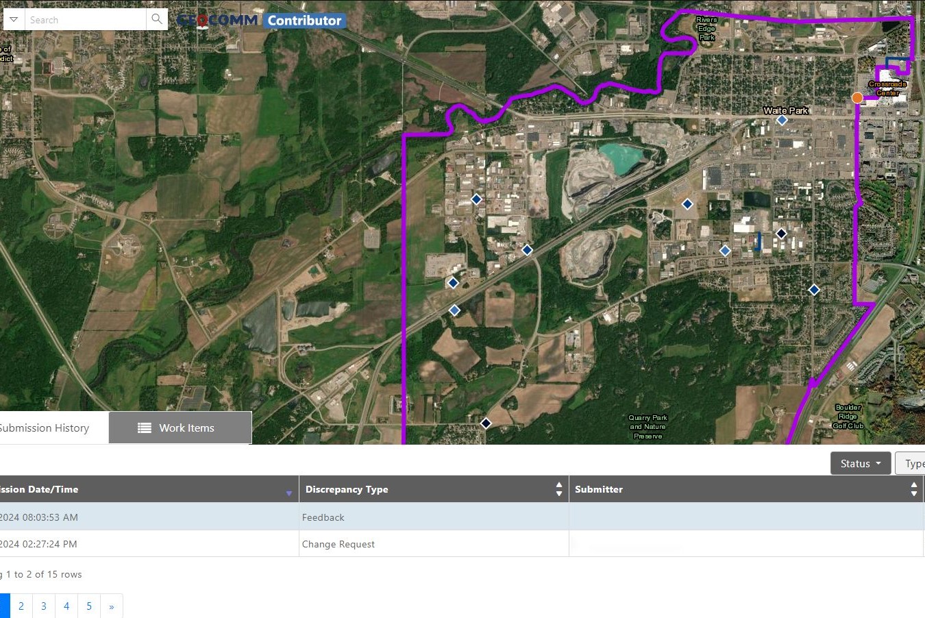
Reduce the complexity of GIS data management with seamless accuracy, quality control checks, and more.
Easily navigate your GIS data, whether you’re a beginner or expert.
From hosting to seamless updates, we fully manage and integrate your GIS data.
From one-time services to ongoing maintenance, we bring your GIS data to the forefront.


“Thanks to GeoComm, we’ve transformed our GIS data to meet NG911 standards, achieving over 99% accuracy statewide.”
99%+
Data Accuracy
Essential Data – Extraordinary Results
Identify and correct errors quickly, keeping your emergency response operations running smoothly.
- Enhanced Data Accuracy
- Simplified Data Management
- Reduced Time and Effort

Data You Won’t Find Anywhere Else
Discover the impact of GeoComm’s GIS Data Management solutions on your community.
Resources

How New Mexico Strengthened Emergency Response with Public Safety Grade GIS Data
Ensuring Accurate Location Data Across 100+ Local Governments. Overview In New Mexico, a largely rural state with vast geographic areas and limited emergency resources, even small GIS data errors can have life-threatening consequences. With more than 100 local government agencies contributing GIS data and over 40 Public Safety Answering Points (PSAPs) relying on that data…

GeoComm Indoor Mapping Integration with Zetron Help Strengthen Iowa Public Safety Response
Integration brings indoor building context into Zetron workflows to help public safety teams respond faster, coordinate more effectively, and improve situational awareness during indoor emergencies across Iowa. St. Cloud, Minn. – April 28, 2026 – GeoComm today announced an integration that brings GeoComm indoor mapping content into Zetron’s Map Viewer, helping support public safety agencies…
Public Safety Location Intelligence: The Future of Emergency Response
Public safety location intelligence is becoming the foundation of modern emergency response. As 9-1-1 centers, law enforcement agencies, schools, and emergency response teams adopt new technologies like indoor mapping, artificial intelligence, drones as first responders, and real-time situational awareness platforms, one thing remains essential: accurate, trusted location data. Without it, even the most advanced public…